 France
 Quebec
Register
en
 Canada (outside Quebec)
Surveying and topography
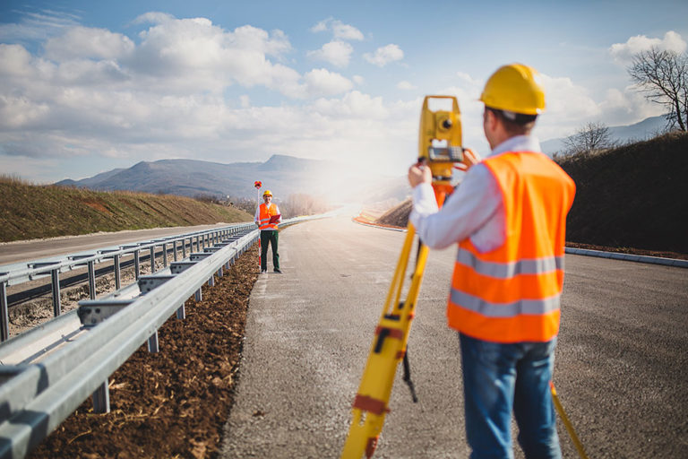
The Surveying and Topography program allows students to develop skills in the surveying profession. It prepares them to embark on a challenging, high-tech career that gets workers outdoors and provides a wide range of opportunities. Students will master typical surveying instruments to gather topographic data, and graphically portray surveys using specialized tools. Potential employers include public sector organizations such as provincial and federal departments of Public Works and private sector firms.
![]() Duration :
1 800
Hours
Duration :
1 800
Hours
IMPORTANT: This training program is not eligible for the PGWP according to the current IRCC list.
academic
prerequisites
* The validation of your eligibility will be confirmed by our admissions department once your application has been completed.
EDUCATIONAL INSTITUTIONS PROVIDING TRAINING
Centre de formation professionnelle Jonquière
Saguenay, Saguenay-Lac-Saint-Jean
Details [+]
École professionnelle des Métiers
Saint-Jean-sur-Richelieu, Montérégie
Details [+]
Legend Welcoming services
Integrating into the community
— Practical tour of the city and help with initial purchases
— Contact with local aid organizations
Reception on arrival
— Reception at airport, bus terminal or train station
Integrating into the school system
— School tour and twinning with another student
— Monthly follow-up with the student
Integrating the family
— Referral to employment agencies for your spouse
— Help with child daycare or school registration
— Information on family social activities
General information and administrative follow-up
— Direct contact with a resource person
— Registration, information and provision of mandatory health insurance card
— Explanation of the Centre’s teaching techniques and operations
Accommodation
— Reserving temporary accommodation prior to arrival
— Help with finding permanent accommodation
Note: Services may vary slightly from one training centre to another.
TRAINING OBJECTIVES
Similar training
Share this training
TRAINING CONTENT


Socialise with us !